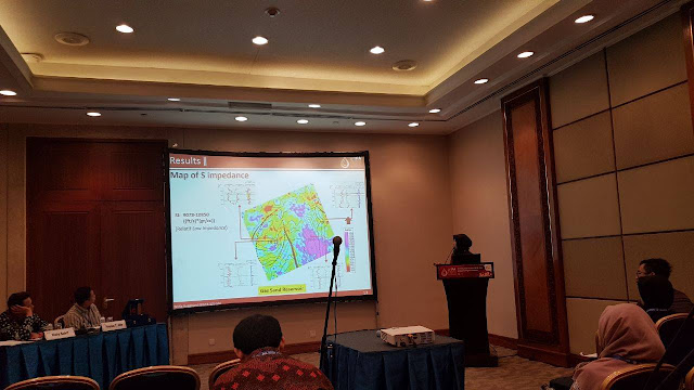
Widia has several experiences in geophysics work:
- Marine Geohazard Site Survey (Unpublished)
- Unconventional Resource: Biogenic Gas Study (Unpublished)
- Reservoir Characterization by using Quantitative Interpretation (Published 2 Papers in IPA & SEG 2018)
- 2D Marine Seismic Data Processing (Unpublished)
- Geothermal Manifestation Identification (Published 2 Papers in IIGCE 2016 & JCM 2017)
"3D Pre-Stack Simultaneous Inversion and Lame Parameter Extraction Applied To Discriminate The Lithology and Pore Fluid: A Case Study - Gumai Formation, Jambi Sub-basin, South Sumatra"
Summary
The Gumai Formation facies architecture is complex and formed
by interbedded sand and shale. The formation has various roles in the Jambi
Sub-Basin petroleum system acting as the regional seal, source rock, and
reservoir rock. This research was carried out in order to discriminate lithology
and detecting pore fluid distribution using Prestack Simultaneous Inversion and
LambdaMuRho Extraction in the Gumai Formation, Jambi sub-basin which is
supported by the proven discoveries of hydrocarbon (gas) while Drill Stem Testing
(DST). The data consists of 3D seismic partial-angle stacks and well log data
which are used as input to three-term Fatti equation to transform the seismic
trace into reflectivity. Further, reflectivity from different angle stacks are
simultaneously inverted to obtain P-impedance (Zp), S-Impedance (Zs) and
Density (ρ). The simultaneous inversion results for gas-bearing sand reservoir
encased in shale gave low P-Impedance, low S-Impedance, and low density. The
Lame parameter extraction, resulted low LambdaRho (Incompressibility) and relatively
high MuRho (Rigidity). Based on these values, combined maps of P-impedance (Zp),
S-Impedance (Zs), Density (ρ), LambdaRho (λρ), and MuRho (μρ) show the distribution
of the prospective areas for gas-bearing sand reservoir towards the western part of
the study area.
"Lithology Discrimination and Pore-Fluid Detection Using 3D Pre-Stack Simultaneous Inversion: A Case Study at Gumai Formation, Jambi Sub-basin, South Sumatra"
Summary
Pre-stack simultaneous inversion is a part of quantitative interpretation as a reservoir characterization tool to identify lithology and pore fluid based on P-wave velocity, S-wave velocity, and density. The Gumai Formation facies architecture is complex and formed by interbedded sand and – shale. The formation has various roles in the Jambi Sub-Basin petroleum system acting as the regional seal, source rock, and reservoir rock. This research was carried out in order to discriminate lithology and detecting pore fluid distribution using Pre-stack Simultaneous Inversion in the Gumai Formation, Jambi sub-basin which is supported by the proven discoveries of hydrocarbon (gas) while Drill Stem Testing (DST). The data consists of 3D seismic partial-angle stacks and well log data which are used as input to the three-term Fatti equation to transform the seismic trace into reflectivity. Further, reflectivity from different angle stacks is simultaneously inverted to obtain P-impedance (Zp), S-Impedance (Zs), and Density (ρ). The simultaneous inversion results for gas-bearing sand reservoir encased in shale gave low P-Impedance value (15,700-18,250 ft/s*gr/cc or 4,785-5,563 m/s*gr/cc), low S-Impedance value (9,078-10,850 ft/s*gr/cc or 2,767-3,307 m/s*gr/cc) and low density value (2.10-2.19 gr/cc). Based on these values, combined maps of P-impedance (Zp), S-Impedance (Zs), and Density (ρ) show the distribution of the prospective areas for gas-bearing sand reservoir towards the western part of the study area.
For detail published works can be downloaded via the official publisher or contact me via email: widiaanggr@gmail.com
Published in IPA: http://archives.datapages.com/data/ipa_pdf/2018/IPA18-125-SG.html
Published in SEG: https://library.seg.org/doi/10.1190/segam2018-2996841.1
"2D and 3D Modelling Resistivity to Indicate the Distribution of Geothermal Manifestation (Case Study: Way Ratai Geothermal Field)"
Summary
The prospect of Way Ratai Geothermal is located in Way Ratai Village, Pesawaran Regency, Lampung Province indicated by the existence of manifestations on the surface. This research is purposed to indicate the distribution of geothermal manifestation based on the electrical properties of rock by resistivity data. The acquisition data were obtained by the use of Ares Resistivity meter Type 850 with Schlumberger configuration, consist of 6 lines in area 44.22 Ha. Processing of the data is inverse modeled in the cross-section 2D and 3D model to obtain resistivity value, distribution of hydrothermal zone, and geological condition. The results show that the resistivity value less than 8.5 ohm-meter is interpreted as hydrothermal intrusion zones affected by saltwater and the distribution of heat water flow in the subsurface. The correlation of the manifestation point based on the 3D model represents that every manifestation in this research area comes from a hydrothermal system interrelated one each other, these phenomena are associated with geological fracture along the river in surface across this area.
"Resistivity Method To Analyze Hydrothermal System In Way Ratai Geothermal Field"
Summary
Geothermal is one of the geological resources that have the potential for renewable energy, geothermal is characterized by the appearance of hot spring and steaming ground (hydrothermal) on the surface of the earth. The prospect of Way Ratai Geothermal is located in Way Ratai Village, Pesawaran Regency, Lampung Province indicated by the existence of manifestations on the surface. This research is purposed to analyze the hydrothermal system based on the electrical properties of rock by resistivity data. The acquisition data were obtained by the use of Ares Resistivitymeter Type 850 with Schlumberger configuration, consist of 5 lines in area 8.6 Ha. Processing of the data is modeled in the cross-section 2D and 3D model to obtained resistivity value, distribution of the hydrothermal zone, and geological condition. The results show that the resistivity value which is less than 10 ohm-meter with 8.68-34.5 meters is interpreted as hydrothermal intrusion zones and distribution of heat water flow in the subsurface. The correlation of the manifestation point based on the 3D model represents that every manifestation in this research area is come from a hydrothermal system interrelated one each other, these phenomena are associated with the geological fracture in subsurface across this area.
For detail published works can contact me via email: widiaanggr@gmail.com
Regards,
Widia Anggraeni


1 comments
Mantap sekali kaaa, semoga aku bisa dapet tiket ke Amerika gratiss
ReplyDelete